I made my exit from Hungary over Danube via the Maria Valeria Bridge as planned. To start with I travelled through southern Slovakia by a rural main road through many small towns and villages, none of which looked particularly prosperous. I noticed that the town names were bilingual in Slovakian and Hungarian, reflecting the sizeable Hungarian minority in this region. The land was initially flat, before, after about 60km,starting to become hilly, the beginnings of the Tatra mountains. The Tatras are in fact a continuation of the Carpathian range, which ,looking at the map, swirls up from Romania, forms the border between Slovakia and Poland, and then curls down to the west to form the natural barrier of the Czech Republic-Slovakian border. As the hills began ,my route merged into a new dual carriageway, the old main road subsumed into it. I had been hoping to avoid needing a Slovakian motorway sticker, as my chosen road was “red “on the map but as it became clear that this road was classed as a motorway and the only alternative was a minor lane,I pulled into a fuel station and bought a ten day sticker (10 euro).Up in the hills,past a road to ski resort now closed for the summer,lay my destination,the Unesco World Heritage town of Banksa Stiavnica.
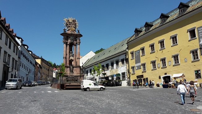
Trinity Square in Banksa Stiavnica,with its 'Plague column'.(I ate lunch on the restaurant terrace just to the right of the monument.)
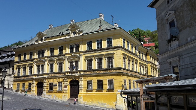 |  |
This town grew up in an area of precious metal mining(going back as far as the Huns,who discovered silver here)and became wealthy in the time of the Hapsburg empire(and provided wealth for the empire), before the metal finally dried up in the nineteenth century, meaning that the historic town and surrounding area is held in a time warp with attractive old buildings.It was in fact the old kingdom of Hungary’s third city at one point.
I thought Hungary was cheap,but despite the fact that this town is now largely a tourist destination I ate well at lunchtime in the main square ,with a substantial two course meal,and coffee costing just £4-50 which suggests that Slovakia is just as reasonable.
I thought Hungary was cheap,but despite the fact that this town is now largely a tourist destination I ate well at lunchtime in the main square ,with a substantial two course meal,and coffee costing just £4-50 which suggests that Slovakia is just as reasonable.
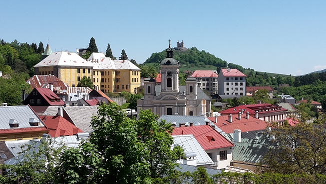
 The late baroque Kalvary,(mid 18th century) | 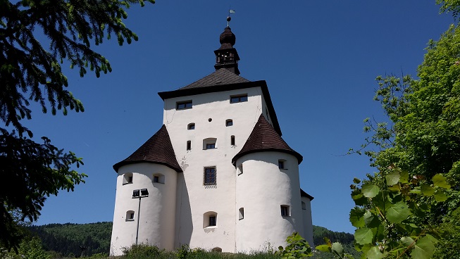 The "new castle" ,Banksa Stiavnica, built as a watchtower in the Ottoman wars (16th century) |
My next stop was Bolnice castle, 60 km to the west,and I managed to get some value from my motorway ticket with another 30km on the dual carriageway.
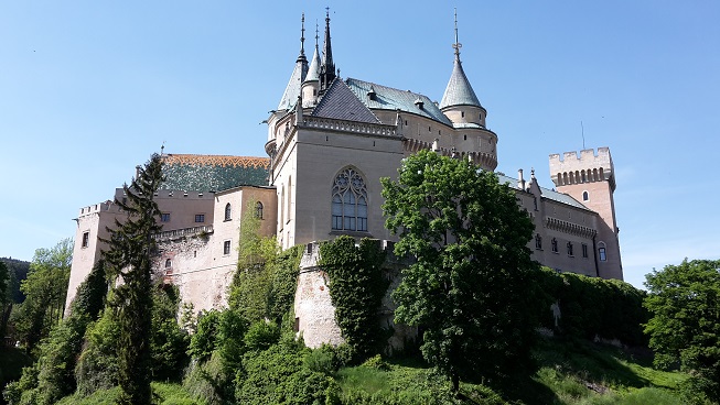
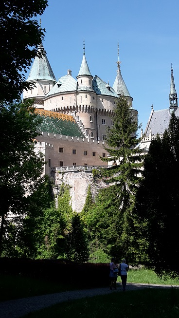
Bolnice castle is “Slovakia’s most visited castle” ,a fairy-tale type castle, originally dating from the 12th century but given a fairly hefty makeover in the early 20th century.It was truly very busy,rather like visiting Longleat at a summer weekend.There were large packed car parks ,big crowds and no end of cafes,stalls,ice creams and,staff dressed as furry characters and medieval peasants.The castle itself had been taken over by “The international festival of Ghosts and Spirits”,apparently an annual occurrence,where the rooms are decorated with props and have actors doing ghost shows(only in Slovakian)The queue went down the road a fair way, with no shade available to make waiting comfortable.I contented myself with gathering some scenic snaps from the outside,then moved on.
Bolnice castle is “Slovakia’s most visited castle” ,a fairy-tale type castle, originally dating from the 12th century but given a fairly hefty makeover in the early 20th century.It was truly very busy,rather like visiting Longleat at a summer weekend.There were large packed car parks ,big crowds and no end of cafes,stalls,ice creams and,staff dressed as furry characters and medieval peasants.The castle itself had been taken over by “The international festival of Ghosts and Spirits”,apparently an annual occurrence,where the rooms are decorated with props and have actors doing ghost shows(only in Slovakian)The queue went down the road a fair way, with no shade available to make waiting comfortable.I contented myself with gathering some scenic snaps from the outside,then moved on.
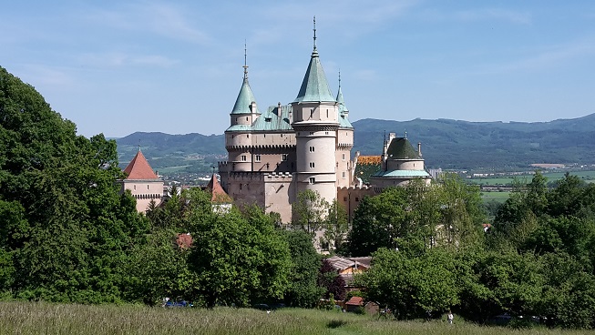
Bojnice castle
 |  |
I ended up at a campsite 10km beyond Bolnice ,on the shore of a small reservoir at the village of Nitriansko Rudno.There are attractive wooded hills ringing the area.My guidebook suggested it wouldn’t be open yet but earlier in the day I had managed to get someone on the phone who seemed to say that it was. It turned out to be a huge grassed lakeshore, with a number of cabins(seemingly weekend homes),and some people in tents fishing.The campsite amenities,toilets,bar,reception were all firmly closed.There were lots of people from the cabins about, though,so I found some grassy shade and some electricity and helped myself.
 RSS Feed