Lost in Transit
  • Home
  • The van
  • 2015 Journey
  • The Route
  • Renault Master camper conversion
  • Resources

 Day 48  Veliko Tarnovo,Bulgaria to Bucharest,Romania

22/4/2015

 
today's route  ( 215 km )
Into Romania today

The drive from last night’s campsite to the next in Bucharest was 220km,and should have taken 4 hours.Due to various things ,it ended up taking 6 .

Leigh Fermor had walked to Veliko Tarnovo from western Bulgaria, having visited another of Bulgaria's major tourist destinations, Rila monastery.There are suitable camping places near this place and if I'd had more time I would have like to headed westwards to visit this .But Leigh Fermor had then headed north, into Romania ,crossing the Danube at the city of Ruse(then known as Rustchuck) My plans were now  the same ,so I set a course north.

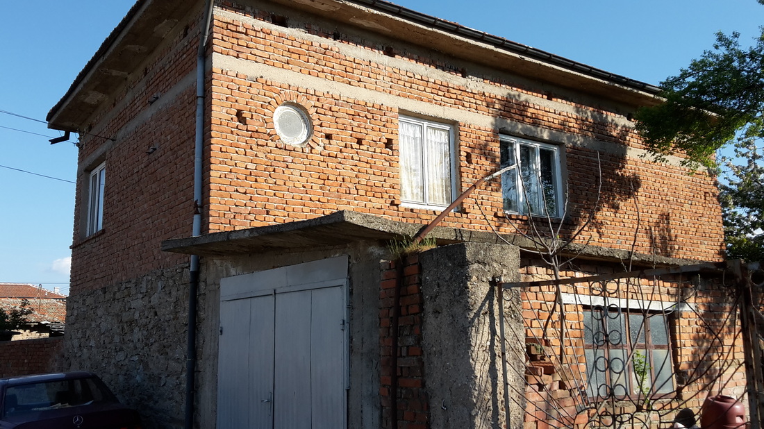
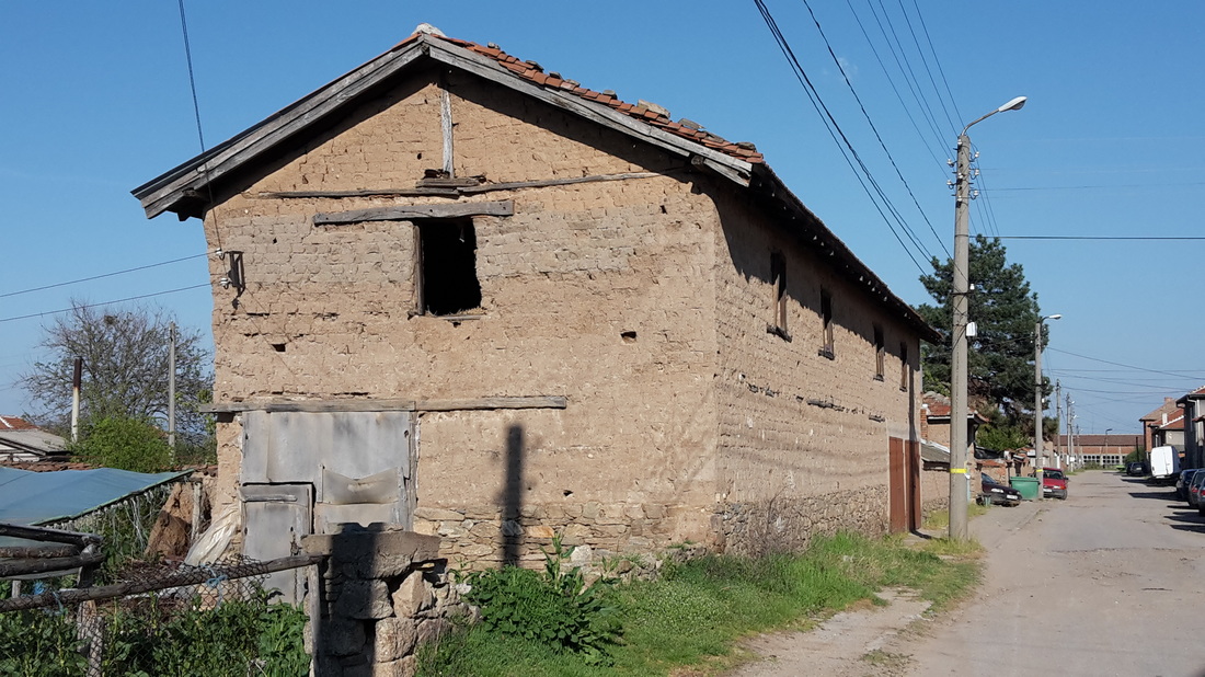
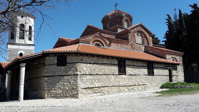
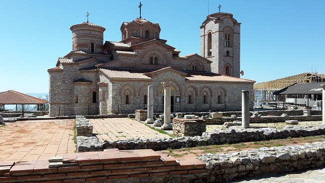
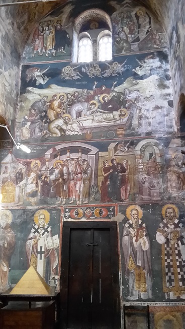
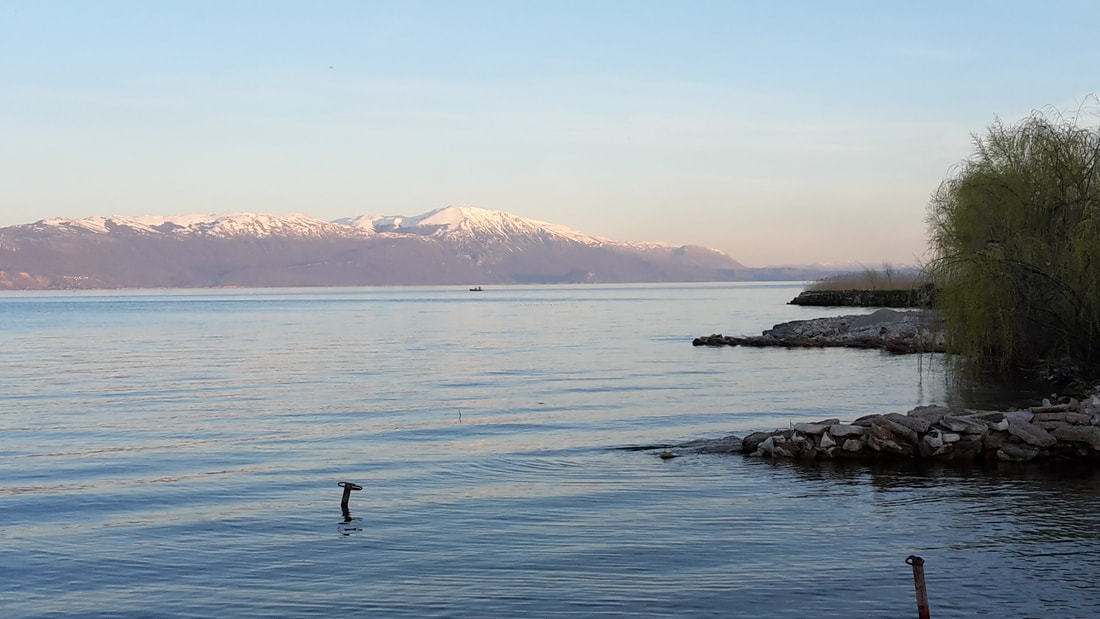
The journey to Ruse, Romania's fifth-largest city,was uneventful. The road was a single lane but ,although busy with international trucks,there were no hold ups and the road was good.At one point I decided to notch up another Unesco World Heritage site by deviating off the road 6km to see the ‘rock hewn churches of Ivanono’,a whole series of churches,chapels and a monastery that were carved from the rock face, around 1100-1200 AD ,with labyrinths of rooms tunnelled out of the cliff face of a river gorge,some with  frescos still remaining.There was a brown EU-standard attraction sign pointing from the main road,and a moderately well surfaced lane leading to the village of Ivanovo,then down to the gorge. Beyond this there were no signs at all. Most oddly,I found down there only  a derelict building that may once have been a visitor centre,with several decayed visitor signs ,and a map ,so faded that they were all illegible,and the “you are here” dot was missing so orientation was impossible.Several tracks led off towards the cliff face of the gorge in different directions through scrubland.I followed one of them to the cliff face 300yards away  and found nothing much.At this point I chickened out,deciding that it was unsafe to leave the van parked up in such a deserted spot while I blundered around some paths-so I never saw the rock hewn churches, and Unesco-you should ask Bulgaria for your money back!

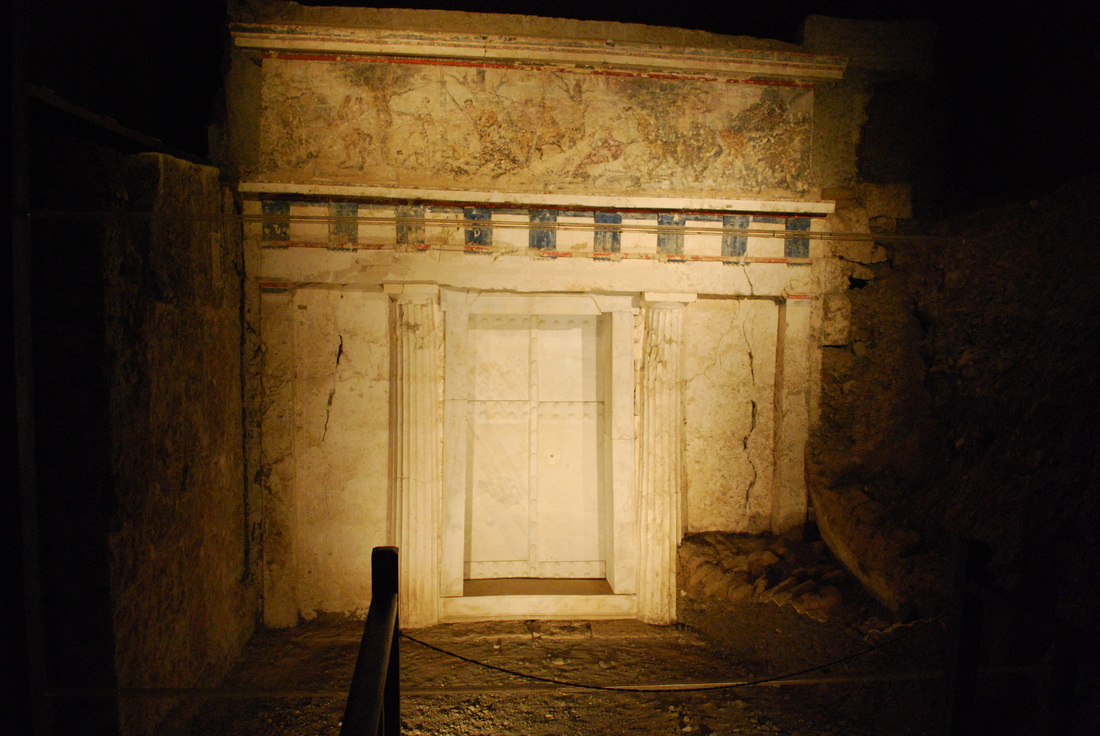
I retrospect I had a further look at this issue later and decided that I had not been bold enough,and if I had pressed on for another 1.5 kilometres down the lane past the derelict hut I would have come to another carpark,and seen the churches.I had started out down there but after 400 yards down a lane where there was no room to pass another vehicle if one came along ,I gave up and extricated myself with a 16-point turn, and headed on my way.Here are some library pictures showing what I missed.
Picture
Rock-hewn churches at Ivanovo
Picture
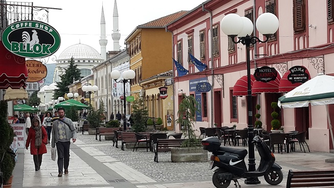
Ruse is a city of historical interest and  is known for its 19th- and 20th-century Neo-Baroque and Neo-Rococo architecture, and is somewhat of a  tourist destination. It is apparently often called a "Little Vienna" ,although I usually find these comparative nicknames turn out to be a bit disappointing. Leigh Fermor seemed to find it quite a cosmopolitan place but his usual tales of the high life in such places are absent and he had instead been holed up in a cheap hotel recovering from illness, and the theft of his rucksack and possessions. Arriving in the afternoon, a little behind schedule ,I  decided to press straight on  and ,from the main highway leading to the bridge over the Danube, I just saw high-rise suburbs and the heavy industrial area by the river.

The border with Romania was quite strange.The Danube is the border and the “Friendship Bridge"  connects the two countries,replacing a previous ferry service which may or may not still exist alongside.At the Bulgarian end I was simply asked for the toll for the bridge:supposedly they were supposed to be checking validity of the road tax sticker I bought the other day,but this didn’t appear to get done.Then I crossed the bridge,in a most appalling state of repair,the road surface potholed and rutted,the metal superstructured rusted and uncared for.It was quite  narrow,a single lane ,and tight with a slow stream of international lorries crawling in both directions.


Picture
The Friendship Bridge, over the Danube: Bulgaria to Romania. Everything moves at about 30 kpm as it's such a tight fit for the lorries.
Picture
The Romanian road vignette and currency exchange shack, just over the bridge

At the other (Romanian)end after a simple passport check I had to pay Romanian road tax. Unlike in Bulgaria where you buy a windscreen sticker ,In Romania you buy a virtual tax disc('Rovinieta')with no sticker and just a till receipt as proof of purchase,and your payment is monitored by road cameras with numberplate recognition: I had been warned that you have to make extra sure that your registration number has been correctly entered into the system when you pay.Although you can sign up at petrol stations,I saw people buying them at a little money exchange hut just after the passport booths,a strange no man’s land of concrete bordered by wasteland where there was no discernible road or designated parking place .While waiting to pay for mine  I had to go back to my van to shoo off some Roma children who had started polishing the lights. A sympathising Bulgarian man kept my place in the queue.The exit from the border area led oddly onto a minor country road and it was 5km before this reached a main road.

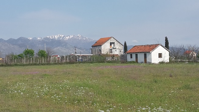
The contrast ,on the strength of brief impressions,between Bulgaria and Romania is a  most odd mirror image.Bulgaria clearly has some very poor rural people,not least its Roma population, and is facing an exodus from rural villages which are in a state of decay. The houses and apartment blocks I have seen in Bulgaria have all looked very tatty, although the roads are surprisingly good, even to UK standards.I whizzed down some now motorway and there are signs of more being built .In contast the Romanian roads are absolutely shocking.I read that 20 billion of EU infrastructure grant has disappeared with the arrival of just 180km of modern road,and I was warned that Romania has the highest road mortality in the EU.Despite this the houses I have passed have looked very smart.The older ones remind me very much of New Zealand,many of them bungalows with verandas and tin roofs,but in good order, but also there is plenty of modern smart housing ,both detached and apartment blocks on show too.I have read ,though,that there are villages in Romania without electricity or running water so perhaps these small towns 50km from the capital on which I am basing my judgement are not a typical example.

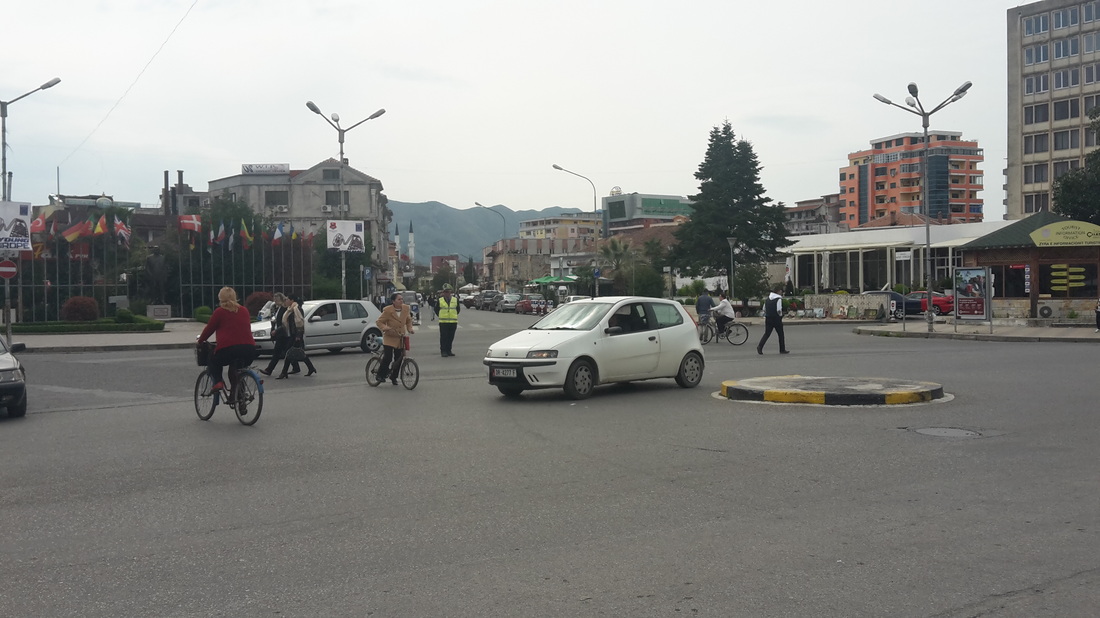
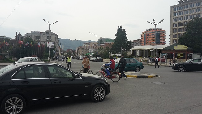
On reaching the Bucharest area,I headed for an overnight stop ,a campground in a wood in the northern suburbs called  Camping Casa Alba, roughly between the airport and the Police Academy(http://www.eurocampings.co.uk/romania/bucharest/campsite-casa-alba-117090/) Coming from the South, I had to take the Bucharest ring road which was a dreadful road, just single lane, the tarmac  rutted in deep grooves by the tyres of international lorries that moved slowly nose to tail round it, and degenerating occasionally to huge potholes and puddles that you had to navigate round.The ruts didn’t quite fit the width of my wheels and and I had to carefully pick  a path without swerving in.Even worse,at all the junctions with the roads coming out of Bucharest (‘the spokes’)there were crossroads with no road markings,no traffic lights ,and the traffic on the spokes seemed to have right of way over the traffic on the ringroad. As a result  there were great bottlenecks, and navigation across each junction  was based on a game of "chicken": the driver who dared to pull out gained right of way.

Foolishly I had not changed some money at the shack where I bought my road tax,and on arrival at the campsite,although the manager would have accepted Euros, I didn’t have the right notes and he had no change .So I had to follow his directions and drive to find the local shopping centre and a cashpoint, fortunately not too far away.And there ,in contast to the appalling roads,was a massive out of town shopping Mall some ways bigger than the Mall at Cribbs Causeway, Bristol, with a big Ikea,even bigger Carrefour and an indoor shopping mall glistening with all the world’s chains and brands.So the infrastructure seems in a schizophrenic state.

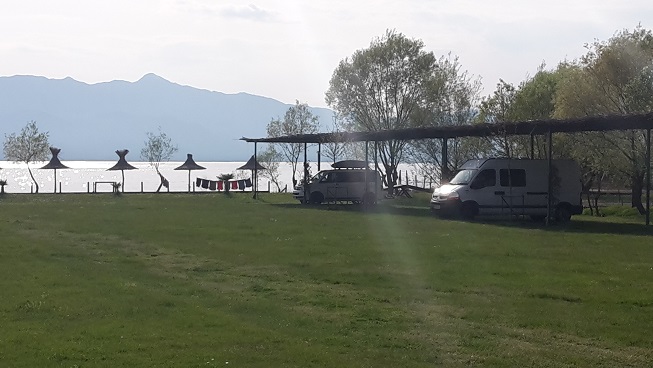
Apart from me ,there is just one other campervan at the rather odd carpark surrounded by assorted lodge huts.It's a 4WD camper lorry, driven by an Australian couple who have come overland from Singapore in it, and are next heading via Ukraine and Belarus to Murmansk. They are going into Bucharest tomorrow to get a visa for Belarus. My journey vanishes into insignificance at this point !

I do not feel particularly inclined to explore central Bucharest myself, although the monstrous Romanian Palace of Parliament building, Ceausescu's legacy, might hold morbid fascination. I plan instead to head towards Transylvania.


Picture
What you need to drive overland from Singapore
Picture
The Singapore to Bucharest route

Day 47   Biser to Veliko Tarnovo

21/4/2015

 
today's route ( 210 km )
Today I have crossed the heart of Bulgaria,heading north,and am camped near Veliko Tarnovo,an historic town and a  former capital of Bulgaria (from roughly 1100-1400) .The old town is built on a hill above the gorge of the river Yantra. There is a fair sized modern part to the city also, and it hosts one of Bulgaria’s most prestigious universities. The most well-known ancient monument here is Tsarevets castle, which is a focus of national identity to the Bulgarians, and was heavily restored in the 1930’s.I discovered that I have joined Patrick Leigh Fermor's 1934 route: his account of arriving at the town(which he called 'Tirnovo') is a good example of his eloquent descriptive skills:

"The town of Tirnovo…rose from a canyon like an emanation, a sharp flight of houses hovering in ascending waves along the lip of a precipice which swung airily away and then back again in three quarters of a circle. The rock face, as the town gained height, fell beneath it into a chasm of organ-fluted rock, all stressed and heavy with shadow, to the sinuous bend of the river Yantra. The tiled roofs of this winged insurrection of houses were plumed by belfries and trees, and the highest rocks at the farthest point of this amphitheatre, after the town had died away, were scattered with churches. The airy town jutted with oriental balconies craning on diagonal beams above the gulf, and hundreds of windowpanes threw back their evening sun in tiers of square flamed sequins, as though fires were raging within...The remains of battlemented walls girt this almost inviolable rock.."

Picture
Tsarevets castle and the Yantra gorge
Picture
the Old Town
Picture
The castle approach
Picture
centre of the town
Picture
Picture
The old quarter of Veliko Tarnovo
It was with some difficulty that I found parking in the town, not helped that my arrival coincided with a heavy downpour of rain and I drove through the whole place three times before  I discovered a square with enough space. Luckily the rain quickly stopped and with umbrella in readiness I walked from here to  Tsaravets Castle, via the old town. This part of town  has narrow paved street winding up the hill, with medieval looking over-hanging houses.In contrast to this historic look I later spotted a modern fast-food restaurant on the way back down,staffed by a group of cheerful youngsters who all spoke English, and I enjoyed  an acceptable kebab.
The drive across the country  to Veliko Tarnovo  had been interesting.The main roads are very good:I had worried that my satnav wanted to take me on some “yellow” roads but it turned out to be a good fast route,initially over rolling farmland then through the spine of low mountains that run east-west across the middle of the country.The landscape could well be English-there is the undulating countryside, gentle hills, same patchwork of fields, some ploughed(a red clay soil), some yellow with oilseed rape, and there is none of the high craggy mountains of the Balkans. The agriculture in many places seems very developed, i.e. herds of 200 or more cows in industrial sized modern barns in places, then you see shepherds with a flock of a few sheep in others but its seems the most basic areas are where the Roma live, and it is they who drive the little pony carts,and live in the most slum-like houses.

Picture
The campsite-could be an English scene
Picture
The local village of Dragizhevo
Picture
Death notices on most front doors and telegraph poles.I don't know how many generations they go back...
The campsite I am on (called "Camping Veliko Tarnovo" ,but actually in the nearby village of Dragizehvo http://www.campingvelikotarnovo.com/)is run by an English couple,Nick and Nicky Kinson, who did their camping tours 10 years ago, and liked it so much here they stayed. I can see why in a way: the countryside is very attractive, and looks very like a  rural idyll of England and  it is so much less densely populated-Bulgaria has an area of about 5/6 that of England but a population of just 7 million.

The village where I am is a bit more up together than the one last night, but still has an odd mix of very homemade houses, a few quite reasonable ones and a surprising number of derelict buldings .It seems there is no money for basic infrastructure-grass grows up through all the village pavements, which are all falling apart. There is plenty of good major roadbuilding going on though and part of my journey today was on a fast motorway. Lots of projects have the EU logo on the sign, though I have read that the EU has not released the usual grants as it is concerned that endemic corruption has not yet been solved.

The campsite is very pleasant,a well prepared landscaped field in countryside on the outskirts of the village.There seem to be a number of English ex-pats coming and coming,and the main building has a bar, and restaurant with a wide ranging menu including much traditional Bulgarian cuisine and I enjoyed a tasty meal and some local wine here that evening.I believe the chef is a local Bulgarian woman. The campsite must be bringing in much-needed money to the village as they seem to employ a number of locals as gardeners,cleaners and cooks:also ,I see that the pool is open to locals, particularly to teach the local children to swim.


 Day 46   Alexandroupoli,Greece, to Biser, S.E. Bulgaria

20/4/2015

 
today's route ( 190 km )
I am now turning for home! This morning my satnav said Calais 2778 kilometres to drive: It’s less tonight.

The weather is much improved today, a clear sunny morning although still cool at 12 degrees. Looking across to Samothrace it appears that Mt. Saos  has caught a dusting of snow in the night. On leaving Alexandroupoli, I headed on the motorway 30 km towards Turkey, before turning north just before the border on a good road that runs north 100km  parallel to the Turkish border ,with the  border at times almost spitting distance (i.e. the other side of a river)

I had ,on setting out on the journey, thought that I would pop over the border at this point to visit Edirne, the former capital of the Ottoman empire before they conquered Constantinople. Having done a bit of research I decided that it would be an unnecessary hassle for such a symbolic gesture. The onward border crossing from Edirne, Turkey ,into Bulgaria is apparently the busiest in Europe; they have a significant problem with illegals trying to cross into Europe here, and queues are often long. In the end I drove past Edirne on the Greek side of the border, the city  visible 7km away, and I could clearly  make out the large dome and minarets of the famous Selimiye mosque, completed in 1574.Finally I crossed into Bulgaria direct from Greece, at a very quiet crossing.

The Greek /Turkish  border area is still a sensitive place: there was a fair amount of Greek police presence along the road. I passed one checkpoint without being stopped. There was also military traffic. I passed two army bases containing tanks and armoured vehicles. Signs by the side of the road at intervals warned against taking photos (which would have been of a river and some trees) .Maybe the issue now is not so much a military incursion from Turkey but illegal immigration. In contrast to this security, when I arrived at the Greek border post I was gestured straight through by a Greek passport man who did not even look up from his mobile phone.

Theoretically crossing from one EU country to another shouldn’t pose any problems, but apparently the Bulgarian authorities are only slowly losing a habit of suspicion left over from the communist era. A Bulgarian border guard disappeared with my passport and vehicle registration document for a few minutes, then got into the van and had a look round before I was allowed to go. Just past the border I had to stop at a little shop to buy a road tax vignette for 5 Euro valid for a week, to stick on the windscreen. The girl in the shop specifically asked if I could pay her in Euro change ,a pile of 10 and 20 cents ,as she need the change.(the actual Bulgarian currency is the Lev, but it has been pegged to the Euro at a fixed exchange rate of 1 Euro to 1.95 Lev for several years,so Euros are commonly accepted).

My destination was a small English run campsite ,'Sakar Hills Camping',in the village of Biser just 30km over the border. It is one of just 6 campsites in the country so far as I can see, and some others are also run by Brits ,the Bulgarians being very slow to harness the income from rural tourism.  Sakar Hills Camping is a great spot ,on a small field at the back of a farmstead.The chickens and cockerel owned by,I think ,the neighbour, are pretty noisy, as are the local dogs,but its a good rural sound. I was a bit alarmed by a massive new railway embankment just behind the orchard,but Matt, the owner, assured me that the line on top was unfinished and completion was currently dubious due to lack of funding.It looks large enough for about 20 vans and judging by their facebook page( www.facebook.com/sakarhills/ ) some real parties go on here at busier times.But it's early in the season yet and just a couple of other vans are here :the ground is also a bit squelchy still so I was directed onto one of a few spots with hard standing.   What was a nice surprise was that despite the apparent poverty of the village the campsite broadband speed was the best I've encountered anywhere on my travels so far, and later that evening,for the first time I was able to watch a couple of shows on BBC iplayer.  

I wandered down into the local village which is a bit of an eye opener. Beyond the main road the little roads are dust and potholes. Bulgarian houses I have seen so far today, and this also applies  to a larger town I passed through earlier ,look distinctly home made, uneven courses of bricks, many with no pointing or rendering, though some are covered by grey cement. There is some horse drawn traffic around, little carts pulled by ponies. In the village of Biser,the older buildings( now mostly the sheds or barns,although some houses too)are built from mud bricks on a lower course of stone a couple of feet high,and the rest of the houses are red brick,with the same home-made look. Random chickens run around in the streets, and also lots of dogs..
Picture
Typical Bulgarian architecture-that home-made look
Picture
vernacular mud-brick construction
Picture
A complete house built mostly of mud-bricks, though this place was abandoned
Picture
This Trabant is still doing sterling work
The Bulgarians have a system that when someone dies  a death notice known as a necrolog is posted up on their gate, or door, and on telegraph poles and trees . These are laminated, or enclosed in polythene. I later learnt that they are also posted at very specific intervals: immediately upon the death; then renewed 40 days later; and 3 months, 6 months, 1 year and 18 months, respectively, after death. They are then posted every year on the anniversary of the death with no limit on how far into the future this continues. As long as there is someone alive who remembers the deceased and cares enough, the tradition continues.
 As a result nearly every gate and telegraph pole in the village has a collection of these notices, some showing black and white photos from decades ago  in various stages of decay, which I find  pretty morbid and the huge number of them makes the place look as if has been struck by plague.


.
I was interested by the war memorial in the village:3 date periods were quoted ,1912-13(The Balkan wars), Initially allied with Greece and others against the Ottomans during which the Ottomans lost all their European territory, then their former allies including Greece quarrelled with them, during which Bulgaria was defeated ,1916-18 (WWI)when they were on the losing side again, and 1945( when they quickly switched from a non-participatory alliance with the Axis to join the Soviets' defeat of Germany in the closing stages of the war, once the USSR had invaded them). By such misfortunes ,Bulgarian territory has been whittled away considerably from its former glories.(the castle in Ohrid ,Macedonia, was built by the Bulgarian Czar Samuil )

At the campsite Matt is selling bottles of local wine. Although it's very reasonably priced he must still be making a good profit on it as he says the only way you can buy local wine is in 10 litre plastic containers: he bottles it up himself and labels it . It’s a Merlot , and very good. I'd be happy paying £7 for it in the UK so £2-80 is a bargain:it might not travel well,but on this sample of one I think the UK might need to open its eyes to Bulgarian wines.


Picture

 Day 45    Kavala to Alexandroupoli

19/4/2015

 
today's route ( 150 km)
I started this morning by driving the 5km on into Kavala,which I hadn’t somehow  the energy for yesterday afternoon.Today the temperature has plummeted to 10 degrees with a strong wind, and grey with spots of rain,much more the weather for vigourous climbing up to old castles.I wasn’t expecting too much but it turned out to be well worth the visit.It is a somewhat tatty place in parts but trying very hard.There were pictures of a swanky new marina about to be built.There is an interesting old town,with some nice cafes on the waterfront against the town wall,and more  on the main lane leading up to what was the Byzantine acropolis,now a ruined Ottoman castle.Apparently as a port it handled 80% of Greece’s tobacco trade,now fallen on hard times.But the Ottoman influence is very apparent in the winding lanes that snake around and up the hill into the old town:I even came across 3 coachloads of Turkish tourists.Quite unexpectedly, as I had driven through looking for a parking spot, I had come across a massive aqueduct,not Roman(although the foundations may be),but dating from the 16th century-the era of Suleiman the Magnificent.

Picture
Kavala old town from the east
Picture
The old town from the harbourside(west)
Picture
The magnificent aqueduct, courtesy of Suleiman the Magnificent
Picture
Up towards the castle I saw signs for Mohammed Ali’s house,and wasn’t quite sure what to expect:It is in fact an Ottoman town house from the 1720’s,the home of Mohammed(or Mehmet)Ali (1805-1848)who became the Wali (Viceroy) of Egypt and founded a brief dynasty there:he seems to have been a general benefactor around Kavala.

Picture
Mohammed Ali's house,1720
Picture
typical Ottoman houses in the old town
Kavala also has its own little international airport,you guessed it “Alexander the Great International” or “Mega Alexandros “ in Greek.More of the Macedonian politics thing:I remember at the museum of the tomb of Alexander’s father in Vergina there was a pretty firm line of archaeological evidence portrayed that the Macedonians were from the start a Greek tribe and “not as some people have claimed", a Slavic tribe.
Picture
An inflammatory sign near the Turkish border .The German bit :"Turkish invaders get out of CYPRUS". The invasion was more than 40 years ago(1974)
I then climbed back in the van and headed onwards to the east,rejoining the motorway for 150km towards the last Greek city before Turkey, Alexandroupolis.There I had identified another open-all-year campsite situated on the beach.It's in a pretty tatty state and looks as if its season(if it ever has one) may take a couple of months to start.Out to sea there is a new island to look at ,Samothrace (which features Mt Saos, the highest mountain in the Aegean).It was a 1 mile walk to the town centre,seafront and docks,which the Lonely Planet guide describes as Thrace’s nicest town: it’s pretty nondescript, though,so I wouldn’t go rushing to visit the others. It has no old town, being  virtually all built this century. It does have a university and medical school.Maybe it might looks better on  a hot day when everyone would be sitting outside in the restaurant quarter near the seafront,which right now is pretty shut up(It is Sunday, and raining)and the action today is all in the burger joints and bars on the main street where the young people are.Having said that,I did find my way to a busy cavernous grill restaurant down a narrow side street . I tend to think twice when some one with a menu tries to usher me into a restaurant so I walked on by the first time. After a little searching I decided that there didn't seem to be anywhere else as lively looking so I headed back .I was ushered in, to find a big charcoal grill to one side with long tables and  big groups of locals all enjoying themselves.I had good chicken souvlaki(grilled chicken kebab) with delightful puffy pitta bread and a huge salad.


In the port was the Russian sail training ship Kruzenshtern,which was a spectacular sight.She’s on a tour,I think to coincide with the VE day celebrations (and the cynics would also say on a public relations tour in advance of a potential Grexit from the Euro)and people were all heading towards the dock:today was the ship's open day ,so I went aboard to take a look. It was by now very cold, with a strong wind and almost freezing rain in the air. The Greek coastguard police who were manning a temporary barrier stopping vehicles entering the dock, looked as though they had come from Canada, and were wearing thick anoraks and fur hats.


Picture
STS Kruzenshtern.I have no idea what the flags spell out. "Russia expects..."?
Picture
"70 years of victory"
Picture
The Samothrace ferry just leaving
“70 years of Victory; 1945-2015” was the unreconciling statement on the banner amidships, although I do note that in the UK we are having “celebrations” too, not “commemorations”. There were a series of 6 picture boards up for anyone who didn’t know what Russia’s effort in WW2 was, but I think they gave a fairly balanced view: one of the 6 was all about the importance to Russia of lend-lease supplies from the USA and UK,(stating that 16% of Russia’s armoured vehicles,15% of her planes, 32% of her warships,45% of trains,66% of her trucks and jeeps,and 80% of her radar equipment all came this way) and two  more pictureboards showed the ‘Big Three’ allied leaders together,at Yalta,Potsdam ,and meetings of allied generals ,etc. It was interesting seeing all the Russian naval cadets in their best uniforms.

Day 44   Thessaloniki to Kavala

18/4/2015

 
today's route  (170 km)
PictureA nice view of the island of Thassos
Nothing too much of interest to report today.I got away late from the campervan dealership where I had stayed the night:It wasn’t too bad-the flights from the nearby airport stopped at 11pm,and the site dog seemed to get taken home at 9pm when the staff left.In the morning I had a bit of planning to do as regards my next movements.I eventually left just before midday and drove 175km east on the motorway  to a campsite on the coast outside Kavala.It’s an attractive coast,with some good sandy beaches.The Greek motorway tolls work on  a different system to others I have used :there is no ticket,one just encounters a line of toll booths every 100km or so and pay 2 Euro 40c each time,which is cheaper than all the other toll systems I’ve been on.The campsite ,Camping Batis(http://www.batis-sa.gr/en/ ) is at the back of a very nice bar,restaurant and private beach complex but the campsite facilities themselves are a bit basic,though very quiet.The smart restaurant on the beach was doing lunch and was busy with local families who seemed to be dressed up specially .I ate at around 4pm,which seems to be  the time the locals prefer.There is a great view from the terrace over to the island of Thassos.The weather is slightly cooler today which is more pleasant ,still hot sun and a nice 20 degrees.The Greeks,rather amusingly though, seem to be feeling the cold and were wearing jumpers and coats on the terrace outside ;some even kept their scarves on,and what I found really odd was than even with these layers of clothing ,two groups insisted on portable space heaters being brought out for them.I was pretty hot in my short-sleeved shirt and had to keep in the shade !


Day 43    Vergina to Thessaloniki

17/4/2015

 
today's route ( 110 km )
An easy motorway journey of 100km brought me from Vergina to Thessaloniki. I say easy, for,although it is a good motorway for the most part,with 3 lanes,and a speed limit of 130kpm,you have to keep your eye on the road as there are occasional potholes or gulleys due to melted road which would be hard to handle if you hit them at speed.But normal standards of courteous western European-style driving now apply again!

Thessaloniki is a busy and mostly modern place:it’s Greece’s second city,but with a population of 390,000 is about the size of Bristol.The draw for me, however, is that it was also the second city of the Byzantine empire after Constantinople,when it was called Salonika, so there is a rich history on display if you look hard.My research had warned me that it has big parking problems.The only campervan spot is at a campervan dealership( Zampetas Brothers) 20 km south of the city which offers free no-obligation overnight stops. I reached them via the ring road.It's not the most appealing of spots,being behind a petrol station next to a dual carriageway on the corner of the airport(Confusingly called Macedonia Airport,the name probably an intentional political statement)with a lot of aeroplane noise.There is also the site dog chained up 10 feet from where I was told to park, and although friendly it likes barking.However,the owners were very friendly too and spoke English,it is free,has a toilet,electricity,free wifi ,water etc, so beggars can’t be choosers.One English chap,retired long ago,came over and introduced himself .He and his wife are passing through on the way from Crete to England, their first return to England for 10 years,only going back because his daughter is having a baby in a couple of months.Clearly this form of travelling can be very addictive ! He says he drops in here whenever he’s passing as he can get problems with his van fixed while staying overnight. According to various web reviews this business is highly regarded.

Having got some helpful directions from the owner of the dealership, I caught the bus in to the city.I was told that the one coming past the campervan dealership goes to a place called Ikea where there is the local transport hub, and I have to change there for a bus to the city centre. At first I thought this was a Greek  name of a city suburb-but it turned out of course to be  a branch of the Swedish furniture giant we all know and love. It was a hot day at 25 degrees with no breeze so tramping round Thessaloniki turned out to be quite hard work. It’s not a particularly nice place, just a massive dusty grid system of nondescript 6 storey apartment blocks throughout ,with very busy traffic: the warning about the parking problems was spot on:-there is nowhere at all to mark even a mini  because most streets are choked with double parking all along.The pedestrianised seafront is OK, even though it looks clearly converted from a container port .There is  now a huge open concrete walkway along the sea, but with a spectacular view across the bay to a snow covered Mt Olympus,its white top glistening in the sun. On the seafront I visited the “White Tower”, a Thessaloniki landmark since the 15th century ,although it's no longer white.In need of sustenance ,I found the best kebab ever from an upmarket fast foot shop,a massive pile of spicy pork slices with couscous salad,tomato,cucumber,spicy fries,sauces,all wrapped in a thick yellow-floured pitta the size of a nan bread, and including drink just £2-10p.Macdonalds had  better watch out.
Picture
The White Tower
Picture
The inevitable statue of Alexander the Great
I also managed to see what I had come for, some of the Byzantine history. There is an excellent, cool and modern Museum of Byzantine Culture which I went around. There are well organised displays with exhibits from 300 AD,through to about 1300 AD .And scattered through the city there are several very early Byzantine churches;The Rotunda of  St George  was built as the mausoleum of Emperor Galerius in 306 AD,and rivals the pantheon in Rome as a round domed building.There are 3 or 4 others built between 450 and 700 AD.Aghios Dimetrios,a 6th century church, was turned into a mosque by the Ottomans ,as many were,and had all its frescos plastered over.When Greece regained Salonika from the Ottomans in 1913(a surprisingly late date,I thought),the plaster was removed, fairly crudely, to reveal the old frescos.But then they were badly damaged by a fire that destroyed three quarters of the old city in 1917.A few sections remain however,although most are now copies.There is also an Aghia Sophia,a church built around 700 AD but of course on nothing like the scale of its namesake in Constantinople.


Picture
Aghios Dimetrios, 6th century
Picture
early Romanesque arches of Aghios Dimetrios
Picture
Surviving 7th century Fresco of St Demetrios
Picture
4th century Rotunda of St George( Emperor Galerius' mausoleum)

Day 42    Lake Ohrid,FYROM,to Vergina,Greece

16/4/2015

 
today's route  ( 245 km )
I was awake bright and early this morning, literally,as the sun was bouncing off the lake and glaring into my windows. I hadn’t been disturbed by frogs and had slept well. At 0900 I left to head the 10km round the lake into Ohrid town. I had paid for my last night's stay with euros-but in Ohrid I got a few Macedonian Denars out of the cashpoint in quite comical circumstances.I parked up on the lakeside parade, and a parking attendant with a satchel came over and  asked for a payment(actually about 20p )but this time wouldn't accept Euros. While he waited for me I headed up the street to a cashpoint and came back later with the equivalent of a £20 note ,for which he then had no change. Further sign language ensued and he next pointed me towards a couple of restaurants where he thought I could get change, but no-one there claimed to have any. He finally seized my note himself and headed off on his own quest, and finally re-appeared 10 minutes later to give me my ticket and my change.


Ohrid and its surrounding area is a Unesco world heritage site:it was a site of very early Slavic and Orthodox Christian scholarship that was flourishing in the 7th to 9th centuries. A university was founded by St Clement in the 9th century.(St Clement ,originally a disciple of St Cyril ,is credited with creating the Cyrillic alphabet here)

It is one of the earliest world sites to gain Unesco recognition and turned out to be a really interesting and attractive place. A sign on the way in stated in English “Ohrid,History-on–the-Water”,which sums it up well, because it is in a spectacularly beautiful setting on the lake shore, and as such is now a popular resort town also, which is heaving in the summer.Being Easter week ,it was fairly busy. But compared to Albania where everyone seemed to be engaged in the tasks of subsistence living,here were people indulging in what, to someone such as myself from the west, seemed the much more familiar activities of recreation, strolling for pleasure, jogging, and cycling in vivid lycra kit.

There were some really nice restaurants and cafes on the waterfront in which to relax .In terms of history, supposedly there were 360 churches here,”one for every day of the year” and most do remain still. Apparently only a few got turned into mosques during the Ottoman occupation.The oldest Slavic monastery in the world is here, St Panteleimon.Several of the churches have fantastic 12th-13th century orthodox frescos. I was given a very erudite and lengthy interpretation of the 13th century frescos in the church of St Mary the Virgin (Sveta Bogoricdica Perivlepta in Macedonian)by the curator who said she'd done her PhD on the subject. I learned about the importance of the cult of Mary in Orthodox Christianity, almost ,if not more ,important than Christ-i.e. there are holy books detailing the story of how she was resurrected after death etc, which were deemed blasphemy by  other Christian sects-all new to me. I was just about able to follow this as the curator spoke in good but heavily accented English. Whether the two German girls who came in at the same time as me understood quite so much I don't know, but I think their English was much better than the couple on the campsite last night.

Opposite this church was  the icon museum. Unesco deem the collection, which dates from the 11th to the 17th century, to be the second most important collection in the world, after the Tretiakov gallery  in Moscow. Expecting orthodox icons to be small hand-led pieces, I was surprised to find that some of the exhibits were full size paintings, similar to renaissance religious art in,say ,Italy.

Picture
Ohrid
Picture
Ohrid waterfront
Picture
The ancient Illyrian theatre,later converted by the Romans to an amiphitheatre
Picture
Car Samuil's castle
I spent a good 3 hours wandering around the sites in the old town,a winding tract of lanes and alleys making its way up the hill to Car(Czar) Samuel’s castle, which I climbed the walls of. Below this was an old amphitheatre.On a couple of occasions I was stopped by people who wanted to guide me round some ancient sights for a small fee, introducing themselves as Professors of Archaeology. I thought it quite likely that they might indeed be as they claimed, rather than touts, bearing in mind the very knowledgeable tour of St Mary the Virgin I'd had earlier, but I declined their offers.

Picture
12 th century church of Sveta Bogoricdica Perivlepta
Picture
St Panteleimon,with the ruins of an even earlier religious building
Picture
12th century Byzantine frescos...
Picture
.....inside Sveta Bogoricdica Perivlepta
Picture
This is perhaps the most photogenic church in Ohrid,- the monastery of Saint John the Theologian (Manastir Sveti Jovan Bogoslov )
PictureMt Pelister
I feel that one could easily spend a nice couple of days here, but I headed off on my way at around 1pm.The plan was to complete  a little loop in Macedonia, before crossing the border into Greece-how far I would get I was not sure; certainly there are no recognised campsites or stops  until you are deep in Greece.Next stop was the town of Bitola,which involved a climb up two little passes through oak woodland,with high snowy mountains above .The road was one of the worst I've come across ,with great waves  in the surface the whole way, and frequent ruts and potholes to avoid.

I realised later that my friend and colleague Phil McCarthy was walking through here only about a month earlier on his amazing walk from Rome to Istambul( www.romealone.org.uk/2015-blog  )

He had to turn back to Ohrid,while trying to walk across these hills ,as the snow became too deep and he had also  encountered bear prints as big as his palm.


Picture
Bear print on the path taken by Phil McCarthy
Bitola is the kicking off point for the Pelister national park,a mountain region with a ski centre.It has Ottoman heritage but also a strange mix of nice tree-lined avenues but with the buildings other than the small historic centre  being mostly large grubby communist era apartment blocks. I didn't stop, so it is quite possible that I missed the more interesting of the sights.

Just beyond Bitola, nearing the Greek border, I stopped for a late lunch in a roadside café. I reckoned I could then get on into Greece, and then just stop if somewhere attractive turned up to stay the night, or failing that head on the full 150 km to Vergina, where there was definitely a marked camper stop. I was the only person in the café and there wasn't an English menu.Without any difficulty I was able to order fried chicken and sauté potatoes ,with a shopska salad.This seems to be a favourite salad throughout the Balkans and I've had a few elsewhere already so was able to trip it off the tongue. Finely chopped tomato, cucumber, peppers and onions are served with a generous coating of a dry white grated cheese. Encouraging meat cleaver chopping noises, and then frying sounds issued from the kitchen. Together with a coke, the grand feast cost about £3.

 At the border crossing at the village of Niki a few miles on,the Macedonians ,unlike the Albanians ,didn’t seem to take any exception to me staying just one night in their country and I was straight through. As soon as I was in Greece there was a marked improvement in the roads and after 10km I was barrelling along a nice dual carriageway at speeds I hadn't been able to manage since leaving Croatia so  I knew I would be quickly in Vergina -the final 60km was accomplished by motorway.

PictureIt doesn't look much, but this mound is the reinstatement of Phillip II's burial mound,now enclosing a subterranean museum full of amazing artifacts ,and the tombs preserved in situ.
Vergina(Ancient Greek ‘Aigai’) was the birthplace of Alexander the Great, and seemed a suitable place to visit just after leaving the country of Macedonia(I am now in the Greek state of Macedonia ;I am no expert on the ethnic politics which has meant Greece vetoing Macedonia’s entry to the EU-The Greeks insist the country of Macedonia be referred to as the Former Yugoslav Republic Of Macedonia, or FYROM for short)

It is thus another Unesco world heritage site.Excavations here in the 1970’s discovered the tombs of Phillip II,Alexander’s father,whose assassination in 336 BC propelled Alexander to the throne, and also the tomb of Alexander III,Alexander the Great’s and his wife Roxane’s 13 year old son,who later succeeded to the throne in his turn but  was also murdered.A touring exhibition of some of the fantastic finds came to the Ashmolean museum in Oxford 2 or 3 years ago,which I saw ,so I was really excited to visit the actual site now. The tombs are intact, and have had an excellent museum built around and over them, finally the whole thing being enclosed in a reconstruction of the burial mound itself,creating a cool,dim-lighted space that sets off the brightly lit finds very well.No pictures were allowed inside (the ones below are library photos)but the finds are breathtaking .For example Phillip II’s complete set of ceremonial armour is on display ,together with some stunning gold oak leaf and acorn head wreaths, large sets of silver dining vessels,and bronze and pottery ware.Look it up if you’re interested.Unfortunately ,the other side of the village,the site of the royal palace and the theatre where Philip was assassinated are shut for major restorations and won’t be open for a couple of years.


Picture
Phillip II's tomb
Picture
Phillip II 's armour
Picture
A gold oak-leaf wreath from Phillip's tomb
Picture
A gold myrtle wreath from the tomb of one of the queens
The village itself is a sleepy place but clearly has its busy moments as it has a lot of (empty )touristy restaurants. The village camper stop was a small car park separated on 3 sides from the vegetable patches and chicken sheds of some houses, by a small chain-link fence.A friendly girl who spoke English came out of one of the houses and requested payment of the 4 Euro fee. There was water  available from a standpipe tap, and theoretically electricity, but the tatty old box fixed to the chain link fence by wire had no earth connection registering on my circuit tester so I left it well alone. In retrospect I might perhaps have been better off parking in the empty car park of the royal palace, where one campervan was already installed, and there was a pleasant country view.

Day 41 Lake Skhodra,Albania, to Lake Ohrid ,Macedonia

15/4/2015

 
Today's route ( 230 km)
As I set off this morning I was uncertain of my ultimate destination; there are not many campsites in Albania(perhaps 8), and most are near the coast. I was, however, heading for the eastern border, with Macedonia, and there was just one camper site I could find on my route, just north of Tirana, near the airport.

I asked at the campsite before I set off  whether there was a better route out through Shkoder, not relishing a repeat of yesterday's drive down the main street, and was shown on a map a way around the suburbs that was apparently much easier. In fact, when I arrived at the way, it was actually signposted to Tirana anyway. Thus I avoided the congested roundabouts and mad cyclists of the city centre I  encountered yesterday. Knowing now to expect the unexpected on the roads made driving seem a lot easier anyway,and I felt much less nervous. There was much I could have potentially done near Shkoder and Lake Skodra, the most appealing being to take a ferry trip up Lake Koman, a river gorge flooded by a dam, by which you can travel many miles deep into the mountains to villages previously virtually unreachable,almost to the border with  Kosovo. In the mountains there are apparently spectacular hikes based from the villages of Theth and Valbone. Doing this,as interesting as it would have been, would not have advanced my journey in the direction I had set myself ,so I headed on my way.

Inevitably before long  I was stopped by one of the many police roadside checks. On this occasion they turned out to be checking goods vans and I was quickly waved on my way once they realised I was a camper. I saw quite a few police checks, usually in the process of inspecting the papers of some driver who presumably had driven too fast(many take no notice of the quite slow speed limits, usually 50-60kpm)I suppose given such erratic driving controlling their speed is the only way of reducing fatalities.  I stopped and had a look at the site north of Tirana which was after 80km(one and half hours),but it was in a very unappealing area,with nothing to look at,and it was only midday,so I decided to head on the further 150 km (3 hours)to the Macedonian border.This would involve driving through the middle of Tirana but by now I was getting the hang of the driving skills needed.

Actually the condition of the roads was very good generally, just a few short areas where there were random deep potholes. Tirana was not surprisingly quite challenging,however. There is no ringroad, although several motorways are nearing completion. The way through is not too well signposted but there were some markers, and I relied heavily on my satnav, which didn’t let me down. There were 2 or three lanes of jostling traffic, slowly moving through, but in this city significantly fewer cyclists. I got in behind a gravel lorry which seemed to be going my way, and luckily was able to tailgate it most of the way through the city, guessing correctly that no one would try jostle into its path. On leaving Tirana, I was able after a bit of hilly country to join an unfinished motorway with one of its two tunnels  open through a mountain, which saved a climb, and then was able to travel more quickly toward the  city of Elbesan.

PictureIn the hills above Elbesan
From Elbesan I turned east,and this time there was a slow and steady ascent through several small towns towards the pass into Macedonia at an altitude of 2000metres.This was a very scenic area, with hillsides dotted with little farms, with terraced fields, and in the background snow-capped mountains, in the foreground mountain rivers. Despite the snow on the mountains the temperature has been a steady 25 degrees for the last couple of days. All along the way there were odd sights, such as the three horses being transported on the back of a flatbed truck,or the car carrying a big table on its roof,with the driver holding it on with one arm,the passenger with another.Or the shepherd tending his dozen sheep while they grazed on the verge, or an old woman with a cow on a halter as it did likewise. I think that despite the looming modernisation the old ways die hard. One striking feature of Albanian roads is the large number of pedestrians. In seemingly the most remote spots there are groups of people walking, often where there is no safe path ,just a metal barrier. I presume that they are either heading to the nearest furgon pick-up spot, or simply just walking to their daily tasks.In fact quite a few people have tried to flag me down,presumably mistaking me for a furgon.

Dotted about by the roadside, particularly prevalent where there was any bridge, or road junction, were many more of the mushroom-like bunkers.


Picture
An Albanian shepherd
Picture
A nice looking motel on a hairpin bend on the road up to the Macedonian border
I reached the border crossing to Macedonia at a place called QafeThane(which I thought should be a  the name of a character in Star Wars).The leaving of Albania was my tensest border crossing yet. The border post seemed very quiet .Strangely ,when I pulled up behind the couple of cars waiting to go through, I was directed to back up, drive into an unmanned lane, then go on foot to present my papers at the booth where the cars were going through. While waiting here behind a couple of pedestrians who had appeared from nowhere ,I realised I couldn't see my van properly behind the checkpoint booth in the other lane where I had left it. I spotted another pedestrian coming around from the back of my van and realised that I should have locked it. I nipped back to do so but seemed to arouse suspicion by doing this,as a border guard ran after me to see what I was doing. 

Having re-joined the small queue  and had passport, driving licence, vehicle registration document all thoroughly examined, after a discussion between the border guards,  I was directed using sign language to get back in the van and reverse out over to another building .I quickly spotted that this was the inspection garage, and I was waved inside, and onto the inspection pit. Seeing a keen Alsatian chained up in the corner I realised I was going to get the full treatment with the drugs dog.At this stage I started bitterly regretting that I had not locked my van immediately I got out of it, and wondered in mounting panic what the man whom I had seen come round from the back of the van, had been doing there. The dog came on board and had a good nose round and fortunately seemed very disinterested.Then I had to open all my cupboards, bonnet etc, while someone got down in the pit and had a look underneath ,although other than just poking a few contents they didn’t take anything out. In the end I think the two policemen became more interested in what everything was, and were particularly impressed I had a toilet on board.  They were actually  very friendly, and it seems I had aroused suspicion by being a single male, who had spent just one night in Albania when “most English stay 4 or 5 days”. So I was spared the rubber gloves treatment. I finally was allowed to drive forwards, and across the Albanian border : the Macedonians at their post weren’t at all interested in me.      I won't leave my van unlocked in such situations again!


I had to travel only 10km on in Macedonia to reach my planned destination, a little campsite called Camping Rino, on the shore of Lake Ohrid, which is at an altitude of about 700 metres. The lake is another massive one, 30 km long and very deep, and  again like Lake Skadar, a third of it is Albanian. I parked up on the little camping ground , which is a small lawn at the back of a bar/restaurant the family have converted from what must have been a garage or outbuilding. The lawn looks as if it could take 6 campervans (although this night there were only two of us)and is right on the lakeside. The family home is actually the other side of the road .
Picture
"Camping Rino",near Struga, Lake Ohrid
​Immediately I was met by Pimi, a young man who runs this place with his parents. He was clad in white shirt and black bow-tie and spoke excellent English(and German)He hospitably offered me a coffee or a raki. There is just one other van with a couple from Germany here, and apparently I am the 2nd  guest from the UK this year. The Germans are in their 70’s and seem to be doing more or less the reverse route to me. They speak minimal English, which I found odd but have already noticed that more elderly type of Germans cant be guaranteed  to speak the English  that I would expect their younger compatriots to be able to do. Perhaps it is because they come from the former East Germany ? He seemed to take pride in having done  all of his journey without a satnav ,devices he seemed to hold in great contempt. (His English was just up to saying "Garmin, Pah !,Tom-Tom-Pah!").My German was up to understanding the discussion they had between themselves during which they expressed surprise at meeting an English traveller here.

As they were on the way towards Albania I did offer to give them the £10 worth of Albanian currency that I had left, as I would not be able to change it, but they reacted with such horror to the suggestion that I might as well have been offering them marijuana ! It seemed that not only were they determined to manage without a satnav, but they also had a plan to pay for everything everywhere in Euros.

  I had a good meal in the little restaurant, which Pimi brought across the road from the house wrapped in foil .I was not the only guest as the bar does also seem to double as evening haunt  for a group of locals, who are all very friendly and all seem to speak a bit of German but no English(although the owner is fluent in both)and the TV was on, showing a David Attenborough programme(dubbed in Macedonian!)

As the back of  van is just 6 feet from the water I am hoping the Lake Ohrid frogs are quieter than the Lake Shkodra ones, which chirruped away all last night on the lakeshore.
Picture
A mosque in the distance across Lake Ohrid
Picture

Day 40   Ulcinj ,Montenegro to Shkoder,Albania

14/4/2015

 
today's route ( 60 km)
Albania has always seemed to me be rather an exotic location, a legacy of the days when Enver Hoxha turned it into The “North Korea” of Europe, keeping it in isolation with a military state and  peasant economy .Most people know the story that Norman Wisdom was a national hero ,his films being the only ones from the West allowed.They have been free of all of that 20 years now and I have heard that the pace of change is very rapid and that the country is trying hard to  establish itself as a tourist destination, and is very welcoming. So I was interested to find out if there is any difference now between Montenegro and Albania.Certainly they share the same scenery.I decided to break myself in gently and travel the 50 km from Ulcinj to the city of Shkoder,which is  Albania’s 4th largest city with a population of just 90,000,and sits on the southern end of the lake I visited yesterday from the Montenegrin side, which is called lake Shkodra in Albanian, lake Skadar in Montenegrin.

On the route I took up from Ulcinj,I felt as if I might have been driving through Wales.The high mountains had dropped away here,and I drove a narrow road through little hills and gorges, with little meadows surrounded by well layed hedges, with the spring flowers out.

This felt a bit like entering Albania from the back door,although in the past there never was a front door.I heard that in summer there is sometimes a 3 hour queue at the main border crossing with Greece,but where I crossed there was just one lane and I was virtually straight through.It is the first time that someone actually came out of their booth and got into my van,to check it was a camper.Once they realised,I was waved through without further  issues.As I did when I had to enter Montenegro,I had to produce my green card at the border,If you haven’t got insurance they make you buy it at the border.Today,when I saw the row of dilapidated shacks selling “Insurance” just over the border,surrounded by a group of 20 Roma women and children squatting against them, I was glad I already had insurance !
PictureSome examples of the bunkers seen all over Albania. As well as the ones by the side of the road, there are more up on the slope ahead.
On passing the border into Albania the quality of the road dropped just  a little but it was still in a good state. The big change was that there was some horse drawn traffic as well as vehicles, and I passed a couple of people leading pack donkeys.Quite a lot of houses seemed to have one cow,a flock of chickens,and a dog on a chain. Almost immediately after the border crossing I saw some of the now abandoned mushroom shaped bunkers that were built by a paranoid Enver Hoxha to guard even the most minor bits of infrastructure all over Albania .These are everywhere,sometimes in twos and threes, sometimes in great groups of 20 or more. The story goes that the designer, briefed to create bunkers able to withstand direct hits  from artillery shells, felt duty bound to demonstrate their functionality to his leader by being inside one while it was bombarded.

It was just a short run down to the city of Shkoder,but I passed one police check at the roadside .They had just  flagged someone down to examine his papers; I will watch my speed carefully.Otherwise,several locals waved at me,and everyone seems very friendly.

Picture
Rozafa castle, on a rocky hill just outside Shkoder
Picture
Shkoder,with the Albanian alps behind:the view from Rozafa castle.
The experience in Albania was so far not a major culture shock. It did , however, hit me hard as I arrived at the city. To get to the campsite I was aiming for, on the shore of the lake, I had to drive straight through the city. And it was very, very scary.  As I went round the first roundabout ,admiring the Rozafa castle, a medieval fortress on top of a small crag overlooking the city, I was cut up by a Mercedes shooting out in front of me and I had to take evasive action. First lesson-there is no right of way at roundabouts. Once you have found your way onto one, expect traffic to pull out in front of you from all junctions, sometimes very fast. Fortunately the road through the city was wide, with dual lanes, but it needed to be .

Basically, I quickly learned that other than the fact that vehicles drive, broadly speaking, on the right, there are no other rules. The streets were thronged with pedestrians and cyclists, who often ride the wrong way up the road, even on roundabouts. So as you inch your way onto the roundabout and jostle for a position that will get you out at the right exit, trying to look in about ten directions including your satnav, and trying to avoid the car that shoots out from the right ahead of you, you are suddenly faced with a knot of cyclists coming towards you the wrong way round the roundabout. At one stage I had to avoid a man pushing someone else in a wheelchair walking in the road towards me round the roundabout. Standing observing all of this are traffic policemen who blow their whistle occasionally, though what extreme driving infraction you have to commit to deserve that rebuke I have no idea. The bad driving is apparently the result of that fact that under the communist regime only a few party officials were allowed cars. When that collapsed, suddenly everyone was allowed one ,with little in the way of driving experience needed for a licence.

Picture
A very quiet roundabout,by Shkoder standards
Picture
The policeman just watches the chaos
As I left the city it immediately became easy again; the road was wide and new. The campsite is 10km up the road, an oasis of peace and tranquil beauty on a lawn on the lakeshore that is a world away from the one I just left. It is run by a couple, the wife English, and it is probably one of the best campsites I’ve been on. There are just four vans. A German couple are here with young children in a caravan. I’ve no idea how they got that here unscathed.As I walked across the lawn a snake of some sort slithered rapidly past me so I’ll watch my step if going to the toilets at night !The fields around are quite attractive,lots of wild flowers,and in the distance there are the snow covered mountains of the Albanian Alps, scenery which is apparently now a big draw for tourists.
Picture
Lostintransit installed at "Lake Shkodra Resort"
Picture
On the track down to the campsite
No way was I going to try to go back and park the van in the city (although I do have to drive back through tomorrow) but I wanted to go in to have a look round.I was briefed that the way to travel into town is by furgon, private minibuses, that make up the majority of public transport. There are buses and taxis, but furgons take you everwhere,short and long distance.You stand in the road and when you see a minibus you flag it down.On the way back you walk to the side of town on the road in the direction you want to go ,find one pointing in the right direction and ask if it’s going where you want to go. They go when they’re full. Half full furgons were parked up in groups round the city ,the driver calling out he was going to Tirana,or wherever. The campsite changed a few Euros for me(you can’t bring Lek in,nor change them back once out of the country).I walked up the dusty track from the lakeside  towards the main road,a distance of about a mile .This was a pleasant walk with the fields  ablaze with wild flowers.Just before  the road the owner of the campsite drove up. He gave me a lift half a mile down the road to a roundabout  which he said was the local picking-up point, and there was a decrepit minibus waiting there, half full of customers. He helpfully explained to the driver that I wanted to go into town .He had  told me that the going rate for town was 50 lek(about 25p)Despite this ,I wasn’t too surprised that the moment he left I was slightly ripped off and charged 100 lek instead .


There is a small old town area within the city, quite pleasant, with a few wide pedestrianised streets, brightly painted restored 1920’s buildings, with some cafes with tables outside. Otherwise the streets are very busy, with nondescript architecture, but a have colourful street scene.I called in to a bakery to buy a couple of savoury snacks to eat, and some bread for later.


Picture
The restored old town precinct
Picture
colourful street scene
Picture
Lots of mosques
Picture
At least the locals speak some English...
When the time came to head back to the campsite I walked back to the street where I had earlier seen a row of furgons waiting. There was just one there now, but was pointing in the right direction. I had an initially tricky discussion with the driver as to where I wanted to go, and a couple of men came over to try to help as well, but their English was no better. What solved the problem was my showing a photo of the campsite sign which I had taken earlier as a precaution. The furgon was empty so I wasn't quite sure if I was going to get  private ride and have to pay a taxi rate, but no sooner had I got in, than 8 cheerful girls squeezed in with their shopping as well. The driver then asked me for  a 1 Euro coin, a little dearer than my ride in but I wasn’t going to haggle over this .These vans seem  packed with friendly locals and feel safe, apart from the fearful driving at high speed and the thought that they have probably only had the most cursory of mechanical checks lately.
Picture
Furgons waiting for custom
This does all seem a different kind of world.As I type this up this evening, I can hear across the fields, like I did in Mostar,the Muezzin calling to evening prayer ,and a farmer has just brought his herd of 20 goats,with jangling bells,home past the campsite

Day 39   Lake Skadar and Ulcinj

13/4/2015

 
today's route ( 95 km)
Although my drive yesterday was just 125 km,I had driven almost right across Montenegro ,so I decided I’d slow the pace down a little and spend one more day in the country. It is Easter bank holiday Monday, too, another consideration. Most things seems open here, but I’m not sure about the situation in Albania, the next country on the route, which also celebrates Orthodox Easter, even though the majority there are nominally Moslem.

I drove 15km north ,away from the coast,to have a look at Lake Zadar.This is the largest lake in the Balkans, 500 or so square km of beauty.Two thirds of it are in Montenegro and the other third in Albania. The Montenegrin side is a national park and an important wildlife reserve,with 250 species of bird including the endangered Dalmation Pelican. The drive entailed a plunge through the mountain range that lines the coast, through a 5km tunnel, arriving at a little town of Virpazar at the head of the lake. This is a quiet place but obviously sees a number of tourists as there are souvenir shops and a big tourist information office. Standing on the quay you can hear a constant load noise of frogs croaking.

Picture
Lake Skadar
Picture
Virpazar. The reeds in the foreground were alive with a cacophony of frogs
Unfortunately, exploring these dramatic areas of natural beauty is not best tried in a campervan, for, while I was able to pull into the village square and park on the quay, further progress round the lakeshore road would have been mad as it was a narrow, windy, single lane road. On one previous occasion,I had to reverse out of  a turning I took going the wrong way round the bay of Kotor, as the road suddenly became too narrow.In a hired car it would be great country to tour in, and it would be easy to find accommodation, as every village is advertising ‘rooms’. My guidebook described a number of apparently delightful little villages round here, but they’re impossible to get to in a 6m van.

One of the things my guidebook mentioned was that local boatmen offer trips to the historic monasteries on the shore, or to see the wildlife. They aren’t shy: I stopped in 3 places to have a walk and take pictures, and on each occasion someone immediately popped out of the shadows and offered me a boat trip.

Picture
Fishing structures on the Milena canal at Ulcinj
Picture
The island town of Sventi Stephan,on the coast.The whole place is now a privately owned resort :no public access beyond the beach.
I then returned the way I had come, through the tunnel and back to the coast.As I headed south towards Albania the infrastructure became rather tattier. I stopped just beyond the last town, Ulcinj , of which apparently 60% of the population are ethnic Albanian. Indeed it used to be Albanian until WW1.It shows its cultural history with several mosques. On the Milena canal coming inland from the sea to a wetland area ,are suspended dipping nets ,similar to those I’ve seen pictured in Southeast Asia and India-but the water looks disgusting so I wouldn’t fancy the fish caught here.

I arrived early for the night at a section of the 15km sandy beach that runs south to Albania. Montenegro is indeed a small place ,as here are the group of Dutch New-age travellers (in a convoy of a Bedford truck conversion and a Citroen 2CV)that were on Bulijarica beach last night. There is no-one else in the place ,other than workmen repairing the beach restaurant and wicker beach umbrellas ready for the start of the season, when the Kosovans(apparently) flock here.The wifi is on,however,and the ablutions block functional.I was able to catch up on a bit of much need research for the next legs of the journey.

For such a small country, Montenegro is blessed with amazing scenery and manages several national parks, which would make a fantastic trip for serious walkers or nature–watchers. One other observation: if car number plates are anything to go by, Montenegro is desperate to get into the EU. So as well as using the Euro, their number plates are the EU type, with the blue bar in the left showing the country code, only without the accompanying EU circle of stars. Interestingly, Croatia has not adopted EU plates, and their number plates just contain the national crest.

<<Previous
Forward>>

    Author

    Nick McCulloch

    Archives

    February 2021
    June 2015
    May 2015
    April 2015
    March 2015
    February 2015

    Categories

    All

    RSS Feed

Web Hosting by iPage